Tokai Shizen Hodo Information
東海自然歩道 情報発信
Released July 16, 2024
Updated April 6, 2025
at first
はじめに
This page provides information on the Tokai Shizen Hodo, for which our institute has started research and study activities since 2023, with a grant from the Global Environment Fund of the Environmental Restoration and Conservation Organization of Japan (ERCJ). As a hiker myself, I would like to walk the Tokai Shizen Hodo. This project was initiated with the desire to respond to hikers’ requests to walk the trail. FY2023 Report and FY2024 Report Japanese only(go to link)
There is no official English description of “Tokai Nature Trail”. The Institute decided to use the name “Tokai Shizen Hodo” because we believe that the literal English translation is not familiar to Japanese people when they hear it and does not lead to mutual understanding.
To allow for a long walking journey as one long connected path.
This was one of our major guiding principles in the survey, as a group of hikers on the Long Trail and those involved in trail management. And another,
How can you say that a road built 50 years ago is still attractive to today’s hikers?
This was the idea. I believe this is true for the entire long-distance Shizen Hodo that have been created in the past. If this is not the case, I believe it is our mission to show a different path for the Institute.
With these guidelines in mind, we conducted a field survey of the current main line to determine the condition of the road throughout. If the main line was impassable due to construction, collapse, or other reasons, we walked along the established detour route, if one existed. If there were no detour routes, we chose our own paths. We also researched other information that would be useful for hikers to plan their walks.
The survey was also conducted with the help of hikers who have experienced the American Long Trail. Ryu “Loon” Katsumata, a trail researcher. Eiji “Turnip” Suzuki of the Shinetsu Trail Club. Photographer Yuji “Nakaji” Nakajima. And Tomoyoshi “Beaver Fever” Tsuchiya of Hikers Depot, who continues to lead hikers. From our company, Shin “Capitan” Hasegawa and Shigeyoshi “Shige” Nyuu, a triple crowner as a researcher. Backup is Kumi Aizawa, who also serves as the Michinoku Trail Club’s executive director. The event was made possible by the efforts of all of these people who are right in the middle of Japan’s hiking culture.
With this survey, as the Trailblaze Hiking Institute,
The Tokai Shizen Hodo can be a long walk that satisfies the modern hiker.
We think so.
We would like to organize and disseminate this surveyed information so that hikers and other users can plan and enjoy a long walking trip on the Tokai Shizen Hodo in the future. Currently, you can download the “Tokai Shizen Hodo 2023 TBHI Survey GPS Route Data (GPX files)” and GPX data compatible with the “Tokai Shizen Hodo Data Book” here. (Note: Requires completion of a survey and a quiz.)
about Tokai Shizen Hodo
東海自然歩道とは

The idea for the Tokai Shizen Hodo, a national trail in Japan, began in 1968 with a visit to the Appalachian Trail in the United States, led by Michio Oi of the Ministry of the Environment (then the Ministry of Health, Labor and Welfare). This initiative, which called for the “restoration of humanity,” attracted a great deal of attention at the time. In 1974, the first long-distance Shizen Hodo was opened to traffic. The total length of the main line and branch lines is 1,343 km (as of 1990). Starting from the eastern starting point, Mt. Takao in Tokyo, the trail passes through Kanagawa, Yamanashi, Shizuoka, Aichi, Gifu, Mie, Nara, Shiga, and Kyoto prefectures to the western starting point, Minoh in Osaka Prefecture, a distance of approximately 1,200 km (based on a survey by the Trailblaze hiking Institute) along the main line. The number of municipalities involved is 60 cities, towns, and villages in 11 prefectures (based on a survey by the 2023 Trailblaze hiking Institute survey). The Tokai Shizen Hodo Liaison Association is comprised of local governments and tourism and transportation businesses along the Tokai Shizen Hodo.
Following the opening of the Tokai Shizen Hodo, the Kyushu Shizen Hodo, the Shikoku Shizen Hodo, and the Kinki Shizen Hodo were planned and opened in succession, and the Michinoku Coastal Trail (formally known as the Tohoku Pacific Coast Shizen Hodo), which opened in 2019, is the most recent long-distance Shizen Hodo.
Currently, there are 10 long-distance Shizen Hodo’ in Japan, covering approximately 28,000 km, and most of them are still managed, but there are some problems in terms of operation, such as not being able to provide the services that hikers are seeking. On the other hand, in light of global environmental changes and the critical situation, long-distance trails are now attracting attention around the world as a place for education to deepen understanding of the natural environment.
We believe that the Tokai Shizen Hodo, Japan’s first national trail, which celebrates its 50th anniversary in 2024, is a long walking journey with the potential to attract many hikers.
Things to know before your hike
歩くうえで知っておいて欲しいこと
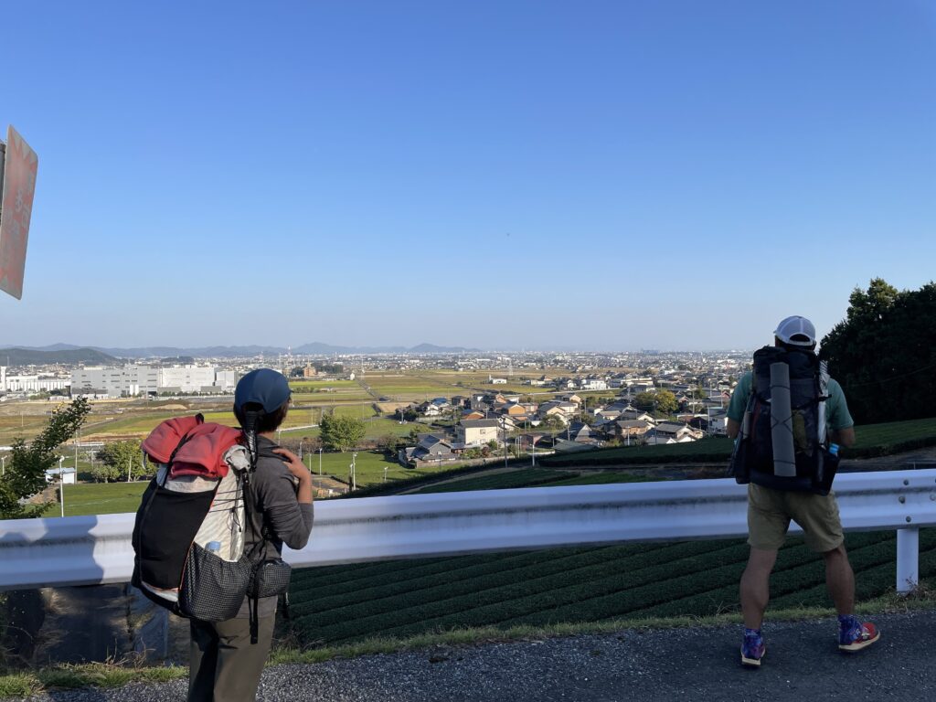
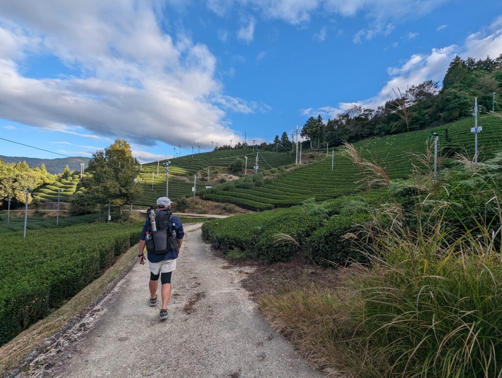
There are some things we need to know about trails. Trails through the mountains are not human territory. It is a place where wildlife lives. It can be close to human habitation even if you think it is in the forest. Because it is a long trail, it often passes through human activity. We want to be aware and prepared as trail walkers and respect their manners.
- Plan Ahead and Prepare / Be Ready for the Unexpected 事前の計画と準備〜万が一にも備えて
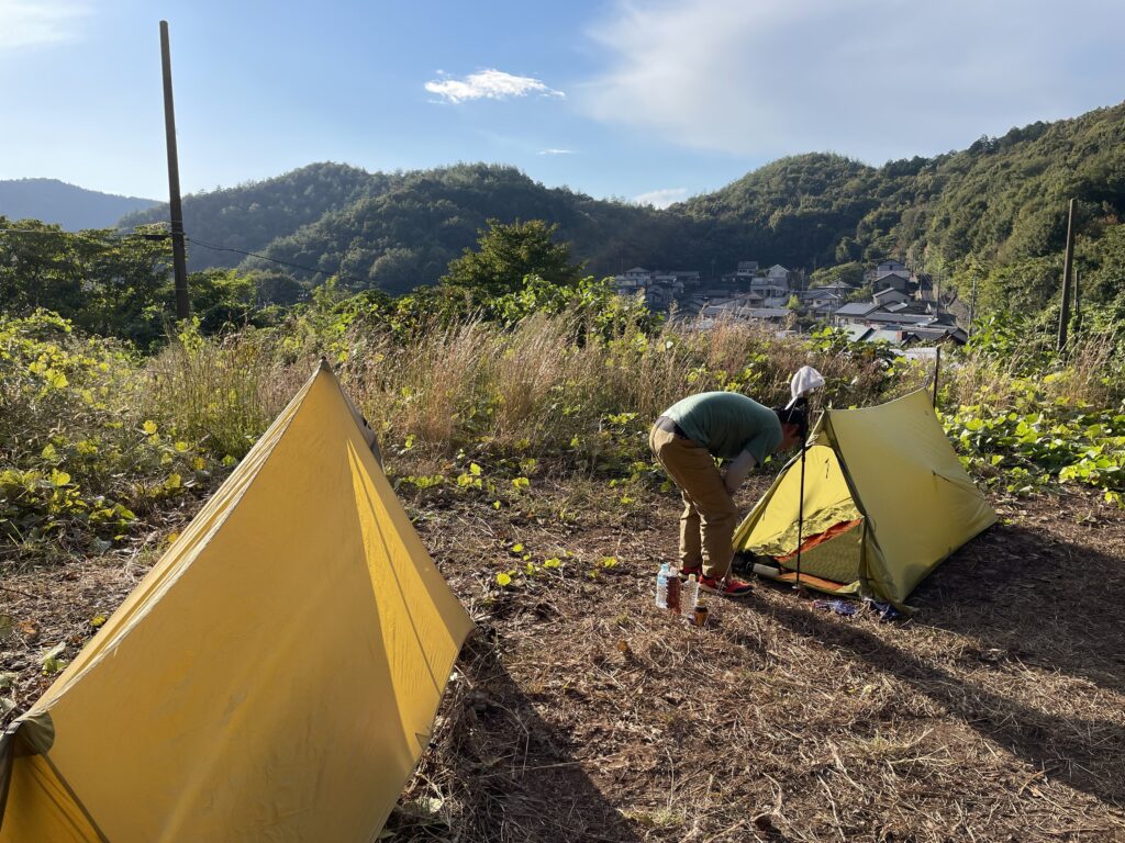
A long-distance hiking journey begins here. Plan ahead, review your plans regularly, and stay informed about natural disasters and unexpected situations. A calm mindset and prepared actions are essential. - Travel and Camp on Low-Impact Surfaces 影響の少ない場所を歩く・泊まる
Please stay on designated trails. When resting or camping, choose areas where environmental impact is minimal. If no designated site is available, consult local residents or authorities. - Dispose of Waste Properly ゴミの適切な処理
Pack out everything you bring in. Consider the preservation of the scenery and the impact on wildlife. Plan to use toilets whenever possible. If you must relieve yourself outdoors, move away from water sources and bury waste in soil where microbial activity is high to promote decomposition and prevent pollution. - Leave What You Find 見たものはそのままに
Do not bring anything in from outside, and do not take anything out. Strive to preserve the current state of plants, rocks, and cultural or historical sites. - Be Very Careful with Fire 火の扱いは細心の注意を
Exercise extreme caution when using fire. Campfires should only be built in designated areas. Use only dead wood that can be gathered from the ground and broken by hand. - Respect Wildlife 野生動物への尊重
Remember that natural areas are habitats for wild plants and animals. If you encounter wildlife such as bears or wild boar, avoid provoking them—for example, by making loud noises—and act calmly. - Be Considerate of the Local Community 地域の営みへの配慮
Trails pass through natural areas that are home not only to wild plants and animals, but also to local communities. Please remember that you are a guest. Offer greetings and show consideration to local residents and fellow hikers so everyone can enjoy the trail comfortably.
◆ Call police 110 for incidents and accidents in mountainous areas
◆ Call fire department 119 for emergencies such as injuries or sudden illness
Notes on survey route data
調査ルートデータの注意点
What you can download here is the GPS tracking data that was taken when the Tokai Shizen Hodo was surveyed by the Toreken in 2023. The plan was made with reference to official information, but during the survey, the direction indicated by the signposts on-site was given priority and the route was walked along the main route. We checked the information provided by the local government and walked along detours where detours were designated. In places where detours had not been set in time or did not exist, we walked our own route. This has allowed us to connect the data into one long walking route. The areas that are misaligned when overlaid with the route data issued by the Ministry of the Environment are the areas that were detoured during the survey. Please refer to this information and make your own judgment. If you are not confident or prepared to do so, please do not use this data. In addition, although the accuracy of GPS has improved, the system does not provide a perfect position. Depending on the radio wave conditions, there may be deviations, so please be familiar with the equipment and system you use.
* Sep 26, 2024 : Updated survey route data to ver. 2.
* Apr 6, 2025 : Updated to survey route data ver. 3 and the latest Ministry of the Environment route data.
* Feb 20, 2026 : Added data matching the Data Book (for sale) and the Hiking Map Book beta version.
- Here are the survey data from the Trailblaze hiking institute. We followed the signposts to what we thought was the main line.
- Where a detour is designated, take the detour. Where there are no detours, take your own route.
- Basically, it can be walked as a long walking journey that leads to one (as of the 2023 survey).
- Differences from the Ministry of the Environment’s route data are to be judged based on the experience of each individual.
- Understand that GPS data itself is inevitably misaligned.
The road is the earth itself. Like all living things, they are constantly changing. As of July 2024, the Tokai Shizen Hodo has not been centralized.
Click on the link below to view a sheet listing information source on the Tokai Shizen Hodo Liaison Association and the websites of the 11 prefectures.
→Tokai Shizen Hodo Information Source Summary Sheet
Each municipality also provides information on its own website. Please check them out if necessary. Tokai Shizen Hodo is easy to find if you search for “Tokai Shizen Hodo **village (or city/town).
Survey & Quiz of GPS route data for download
GPSルートデータダウンロードのための
アンケート&クイズ
Please click here to answer the questions and take the quiz. If you agree with the Institute’s thoughts, you can download it.
*September 26, 2024: Survey route data changed to version 2
*April 6, 2025: Survey route data changed to version 3 and the latest version of the Ministry of the Environment route data. Before using the data from the Ministry of the Environment, please read this → 東海自然歩道全線_250331データについて(English translation available)
*Feb 20, 2026: Added data matching the Data Book (for sale) and the Hiking Map Book (beta version).
Additional Route Info
追加ルート情報
Information provided or obtained through supplemental surveys, etc. since the 2023 survey is added below and is recommended to be used in conjunction with the 2023 survey route data.
- Information as of July 2024
A detour was set up in Togura-Tatsuyama-cho, Tenryu-ku, Hamamatsu City, Shizuoka Prefecture, but now you can walk almost the entire main route with only a slight detour. You can download the GPS route data for the detour route. Please use your own judgment regarding the situation on the ground. (GPS data of the route that has been opened to traffic)
Thank you to the Community Development Promotion Division of the Tenryu Ward Office, Hamamatsu City, for providing this information.
- September 2024 Update
The “Yotsuya Senmaida (Yotsuya, Shinshiro City, Aichi Prefecture)” portion of the TRIZ survey route data released by September 25, 2024 has been revised and changed to “tsh_survey23_tbhi_ver2.gpx” on September 26, 2024. If you downloaded the data before September 25, If you downloaded the file on or before September 25, please download “YotsuyaSenmaida_survey2023.gpx” additionally and use it when passing through the relevant area.
- December 2024 Update
The detour near Enryakuji Temple in Shiga Prefecture has been eliminated. The 2023 survey route data uses a cable car for the detour. Please note that there is a discrepancy with the GPS data.
- April 2025 Update
The download data has changed.
It has been changed to “tsh_survey23_tbhi_ver3.gpx” with minor corrections. The Ministry of the Environment route data has been updated, so it has been uploaded as the latest version.
It can also be downloaded from the Ministry of the Environment website. The data that can be downloaded from Toreken is part of the same data (only the main line, Ena Route, and Shiga Route). The file names of the original data are “0, 1, 2”, but the file names have been changed.
- February 2026 Update
New download data has been added to match the official Data Book (DB) and the Hiking Map Book (MB) Beta version. The relevant files are “TSH_DBMB単線2509.gpx” and “TSH_DBMB複線恵那・滋賀_2509.gpx.”